Everything you've ever wanted is on the other side of fear.
George Addair
Trill News

The Sneaky Way Pokémon Go Became a Massive Robot Training Program

Mack DeGeurin

Summary

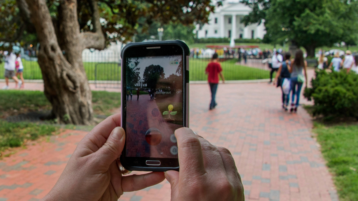
Niantic Spatial, the company behind Pokémon Go, has partnered with delivery robot company Coco Robotics to use its Visual Positioning System — a navigation tool trained on over 30 billion images captured by Pokémon Go players — to help robots navigate city streets more precisely than GPS alone. Unknowingly, years of players scanning real-world landmarks while hunting virtual creatures has created a massive crowdsourced mapping dataset that will now guide food delivery robots to their destinations.

Nearly a decade ago, Pokémon Go turned the real world into a digital scavenger hunt, with virtual creatures hiding in plain sight. The early augmented reality smartphone app prompted hundreds of millions of players to wander into parks, parking lots, and even dimly lit alleyways, peering through their phone cameras in search of Pikachus and Charizards that the app superimposed onto their surroundings. It was a major hit. But 10 years on from the app’s peak, it turns out that digital creature catching may now help that piping hot pizza you ordered find you.

This week, Niantic Spatial, part of the team behind Pokémon Go, announced a partnership with Coco Robotics, a company that makes short-distance delivery robots for food and groceries. Soon, those robot couriers will scoot around sidewalks using Niantic’s Visual Positioning System (VPS)—a navigation tool that can reportedly pinpoint location down to a few centimeters just by looking at nearby buildings and landmarks. Niantic trained that VPS model on more than 30 billion images captured by Pokémon Go users, and claims it will help robots operate in areas where GPS falls short.

In other words, all that time users spent wandering around playing Pokémon Go will now help determine how well a courier robot can deliver your take out. It’s a stark example of how crowdsourced data, seemingly collected for one purpose, can be quietly repurposed years later for something quite different.

“It turns out that getting Pikachu to realistically run around and getting Coco’s robot to safely and accurately move through the world is actually the same problem,” Niantic Spatial CEO John Hanke said in a recent interview with MIT Technology Review.

Instead of helping users navigate the way that GPS does, VPS determines where someone is based on their surroundings. That makes Pokémon Go particularly useful as a data source, because players had to physically travel to specific locations and point their phones at various angles. That mapping effort got a significant boost in 2020, when the app added what it called “Field Research,” a feature prompting players to scan real-world statues and landmarks with their cameras in exchange for in-game rewards. A portion of the data also reportedly came from areas known as “Pokémon battle arenas.”

Whether players knew it or not, those scans were creating 3D models of the real world that would eventually power the Niantic model. More data means better accuracy, and because Niantic was collecting images of the same locations from many different users, it could capture the same spots across varying weather conditions, lighting, angles, and heights. There’s no shortage of raw material to draw from either. At its peak in 2016, Pokémon Go had around 230 million monthly active players. Though less culturally relevant in 2026, the game still hovers around 50 million active users by some estimates.